
7 Day Central Drakensberg Traverse 2016
My wife and I flew up for a wedding recently in the Natal midlands. To maximise the mission we decided we might as well go for a hike or two in the Drakensberg seeing as though we had flown from Cape Town to Durban. In the end, we went on a great 22km day walk around the corner to look at Champagne Castle and Ships Prow Pass and then back to the Monks Cowl office. It has been a few years since I had last hiked in the Drakensberg and after that I was chomping on the bit to go back, the fire had been lit, there was only one thing I could to quell the flame. Just over a month later I bought an air ticket, this time to Johannesburg.

The plan was simple. Fly to Johannesburg on Saturday 7 May to meet my long time windsurfing mate Sean Robertson, buy some groceries and leave Sunday for the Berg, starting to hike on the Monday or so. We would stop on the following Saturday at which point his very kind girlfriend would drive down to pick us up and run shuttle. The potential closure of the Amphitheatre due to the recent brutal attack on three hikers left us wondering what to do. Initially our plan had been to hike from the Sentinel car park and walk south. Reports left many unanswered questions and even an attempt to get radio frequencies from the parks as well as mountain rescue resulted in closed doors. I’m not certain why, as we mostly did not have any cell phone signal the entire trip. I probably should have taken my VHF with anyway as it can scan and lock onto any frequency. Be that as it may, we decided to start from the Cathedral Peak Hotel and walk, still south, to either Monks Cowl, or Injisuthi. This suited us just fine as the scenery would still be grand, and it probably suited our loved ones even more so.
That Saturday night resulted in a classic (well more chilled than the classics in the early millennia) braai that included school friend Pieter Henning and a round of darts that Sean and I managed to win after being down almost half of Piet and Aniques’ score! Many Captain Morgan’s were sunk and it was more or less decided that we would start hiking the next day!

Packing at home.

Packing at Sean’s house. Me on the left.

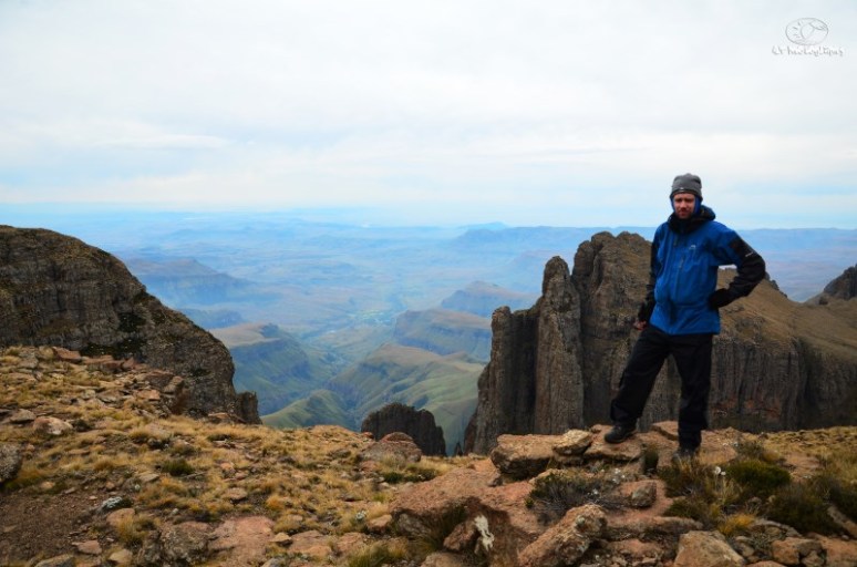
Sean signing the mountain register. PLEASE NOTE: At least half of these are poor quality cell phone photos. It was easier to reach for the phone than take off the pack each time! All “proper” photos with a Nikon D7000 and a standard 18-105 lens. I did not want to pack more than one and did not want to hike with something too expensive.

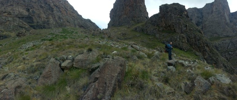
Sean a few hundred metres into the hike.


Me early on.

Still gaining altitude.

One Tree Hill – many hills.
Day 1 – 8 May 2016
We arrived at Didima and paid our fees of R720 for 2 people to spend 6 nights out hiking, R60 per person per night if you left mathematics alone at school. Dirt cheap for the experience you get. Sean and I spoke and said actually the experience is worth far more. If it was assured that our money would go towards maintenance of paths and ensuring our safety (as much as could be assured anyway) and could benefit the Basotho people somehow too, we would pay far more. For the readers not familiar, we would be hiking high up on the escarpment of the Maloti (Afrikaans spelling is Maluti) which forms the border between South Africa and the Kingdom of Lesotho. Straight from the Wikipedia, “The range forms a high alpine basalt plateau up to 3400m in height. The highest point, 3482 m high Thabana Ntlenyana, is located in the north-east of the range. It is the highest peak of Southern Africa, and the highest in Africa south of the Kilimanjaro. The 3291 m high Namahadipiek, the highest mountain in the Free State, is also part of the Maloti Range. Snow and frost may be found even in summer on the highest peaks.”
Another very interest fact about Lesotho, also from the Wikipedia, “It is the only independent state in the world that lies entirely above 1,000 metres (3,281 ft) in elevation. Its lowest point of 1,400 metres (4,593 ft) is thus the highest in the world. Over 80% of the country lies above 1,800 metres” So there you have it, we were off into the mountains.
Lesotho is an interesting place. As is expected, the original inhabitants were the San people, and examples of their rock art can be found by those that know where to look. Please remember that caves NOT shown on your maps are illegal to camp in and if you’re unsure, if the cave has rock art, do not overnight in the cave! Please do not make fires or use candles either. The Didima area in particular is very rich in rock art and if memory recalls it is the highest concentration of rock art by early man in any part of the world. You will find these images on the internet, in forums and on guided tours from Didima but the real gems are those guarded by people willing to hike and clamber to these spots and best left not advertised to clumsy tourists. I just saw some idiot had written the words “Spyda” on a rock about the size of a VW Transporter in one of the Grindstone Caves. I felt ashamed to be human.
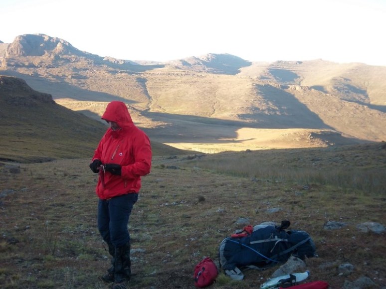
Anyway, I got a bit sidetracked there. So we left our car at the hikers hut and started hiking at 12:45 which was rather late. I think Sean had taken the Sunday cruise to heart! It had (sadly) been more than a year since I last carried a heavy overnight backpack. The weight of this behemoth on my back felt unreal. Sure, I was 19kg heavier than Sean and according to his highly pessimistic scale I weighed a solid 96.6kg, and my pack would weigh about 27/28kg so I had the honours of carrying the full weight of the tent to maintain the “never carry more than 25% of your body weight philosophy”. However the MSR Mutha Hubba NX comes in at only 2.1kg so I accepted my rather mild burden and soldiered on. I think my scale at home was on the 93 to 94kg if weighed in the morning and to be honest at six foot and with my frame I am very skinny at 86kg and should be 90kg typically. The death of my father in November 2014 prompted me to think that red wine would solve all problems and I even went up to 98 kg at a stage! Months of mental pain summarised in a single sentence. Moving on.
It didn’t take long to get into the swing of things. My plan was to hike slowly and thus not get too much anaerobic exercise in and save ourselves from unnecessary lactic acid build up. Sean mountain bikes about 1300 km per month and is an absolute machine with few being able to beat him on the Strava records in his area. For most of the trip he was the uphill master and had to wait for me, whilst I killed him on the downhills and I had to endure painstaking hours watching the old man descend. And then there is me, living 25 minutes from Cape Town (Milnerton) I have quick access to the mountain and make use as best I can. On a good week I am hiking 3 to 4 times a week, otherwise once, sometimes far less. Either way I am used to carrying a small load on my back and more importantly hiking, up and down, comes naturally to me. I come from a very different background to most normal people in that I never did any sport at school and to this day I despise competitions. I could never see the point of cycling with thirty thousand other people to do 100 km. In my mind, if you want to go and cycle 100 km, then wake up one Saturday and go and do it alone without the proverbial carrot. To me, fishing off the wall at Homestead Dam in Benoni was a lot more interesting than soccer or cricket. In matric I started windsurfing and for the next 17 years the sport has been good for me. In 2004 I started whitewater kayaking and became sponsored three years later so I guess I’m reasonably fit in various respects, but mostly in my upper body, and by no means a machine. It was only in the last 3 or 4 years that I started hiking and doing a tiny bit of running.
I (both of us!) made the first and most critical mistake of the trip within 30 minutes of starting the hike. “Ah, this grass is quite wet”
“Ja but it’s not that bad hey!”
Jeepers what a mistake. At first I thought the grass wasn’t that wet. I mean, it was after midday. I had purposefully left my gaiters attached to the outside of the pack for just this situation. I also had waterproof trousers nearby. When I finally realised my pants were saturated, I still continued to make the error of not putting on the gaiters. It wasn’t long until my socks felt wet. Incredibly, I still thought “too late for gaiters I’ll leave them off”. Yes too late, but I could have prevented the deluge from penetrating further. In the end we trudged on, up via One Tree Hill in what would become walking in water. I must add that I was in La Sportiva boots which I’ve used a good couple of times before and they are leather with a full Gore-Tex inner. Really super boots and always 100% dry even walking through water, but our mistake was so amateur not even these boots could save the situation this time.
 Finally away from the trees on One Tree Hill.

In real life that green moss was like a scene out of Avatar.
 The next morning spirits were up.
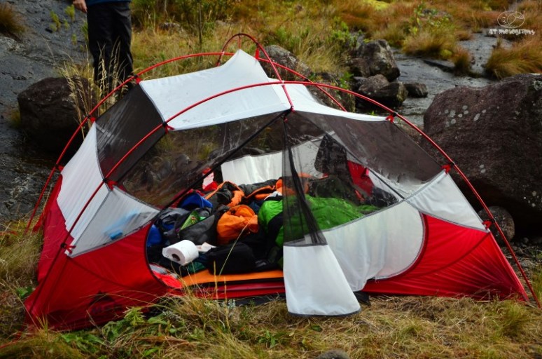
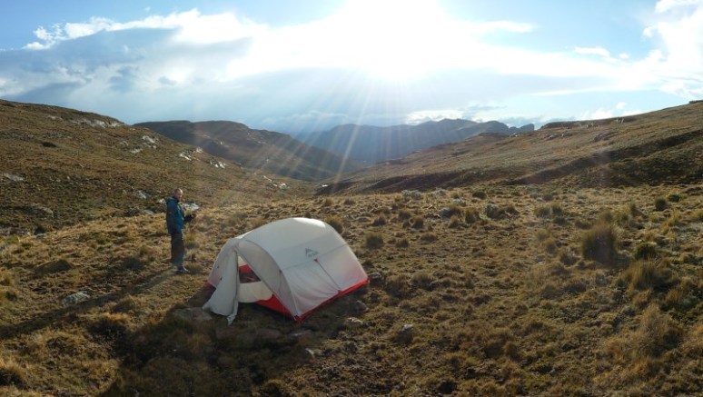
 The tent has loads of room.
What a misnomer – One Tree Hill. I think they forgot a few zeroes after that one. To be clear, there are many hills on that hill, which is quite pleasant on the eye, but less so when you have to constantly duck under them to avoid getting caught up. The afternoon wore on and eventually the mist pulled in. Our late start now meant we were running out of sunlight which is something we had not really anticipated. Headlamps donned, we hiked the last hour or so in the dark along a very wet and grassy path. The map indicated a camp site at the Mlambonja River, and when we arrived we found two potential sites. The one right in the river was the best, but small. There was no danger of rain so we camped right in the river bed itself which turned out to be rather unsurprisingly, lumpy. Sleep came relatively easily.
At the end of every days’ hiking I will summarise the facts as follows. Note that I never pause my watch for stops and lunch etc. so total time is time until we stopped for an overnight.
Day 1 Summary:
Time: 5 hours 35 minutes
Distance: 10.82 km
Ascended: 778 m
Descended: 202 m
Day 2 – 9 May 2016
The next morning we woke up to still a fair amount of mist. The start was slow and motivation not great with our sopping wet boots. In time the mist gave way to incredible views to the south but the Cathedral side remained mostly hidden. We eventually got going at 09:47, very late indeed.

Morning of day 2.
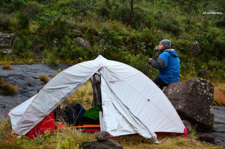
The Mutha Hubba without her flysheet.

Having to keep warm.

Our tent, smack bang in the middle.

The pass goes up on the right valley.


The other potential camp is just behind and to the right of Sean’s head.
The path set on a steady incline going only one way, up. Generally the going was not bad at all until we got to a short but very steep section that required us to remove our packs and ferry them down. I don’t know why the path chose to go down such an annoying slope but it did. I must also mention that everything was quite wet and therefore slippery. The pass has quite a few power moves, requiring high step ups using handholds too with little drop offs into the river below. Nothing scary but it goes without saying that a fall would result in broken bones, or worse. The bigger moves were taxing and made for slow but good progress. The slipperiness and sometimes also the growth of plants and bushes on the path made for a slightly harder than expected day but we soldiered on. If I recall we left the river behind at around 2500 metres, at which point the path became more rock and grass which made the going steep, but easy. Of course from 2500 metres there is no more water, but this wasn’t a problem as I carried a 3 litre Platypus hydration bottle with me.

Looking up from camp at night 1. Pass on the right.

Pass on the left side of the picture.


This descent was steeper than it looks.

A fairly typical view of the Mlambonja Pass.

Somewhere up the pass.

Higher up the terrain is open with a great path.

The final section after Twins Cave. Not that we walked to Twins, but this turn off is just before it.

Almost at the top of the pass now. Too bad we had mist!

Sean probably just after halfway on the pass.

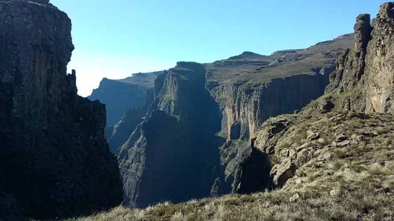
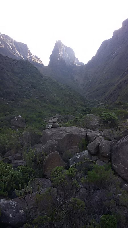
Looking up to the Inner and Outer Horns, I think.
Near the Twins Cave we took a left up a badly eroded section and startled three large baboons that scampered ahead of us. I had been leading all the way and feeling good whilst Sean had been in a bad patch for a long while but the last bit the roles reversed all of a sudden and I could feel the strain of my heavy pack. Perhaps he saw the top and decided sprint for the finish. When we got to the top the mist was still hiding the best views of the Cathedral range unfortunately, but we were glad to have completed our ascent and at the time I thought I wouldn’t be easily convinced to head up that pass again. Looking back now, it wasn’t too bad – certainly nothing as mentally demoralising as the trees and boulders at the bottom of Ships Prow, but more on that later.
The view into Lesotho was so very different from what we had been climbing up with rolling hills and not a tree in sight, typical scenery though for the country. It was late in the day (because of our late start) so I took the time to scan the hills with binoculars to see if I could spot any animals which would also indicate the presence of any Basotho people. I immediately regretted my decision of taking along a cheap pair of binocs as the lens quality was bad and coupled with low light did not make for a good combination. I had left my small Nikon’s at home because they were significantly more expensive, and also heavier. As I could not spot any animals or people, we took a diagonal route down towards the Kwakwatsi River and made camp with a few metres of it at an altitude of just over 2900.

Top of the pass, looking north.

We camped next to the river centre of photo, more or less.

Dinner being prepared.

I balanced the camera on a pot and took this exposure which was just shy of 31 minutes.
As darkness came the temperature dropped significantly. We cooked in the one vestibule making any trips outside of the tent as short as possible. I had never used this tent before and we were beginning to notice just how much mesh the tent had. It’s billed as a three season tent, but in the end I am very happy with my decision. It survived rain, sleet, snow and wind. As a three man, we slept on either side with our packs in the middle and space was decent. Condensation was never an issue. It was only an issue that first night in the river bed because we couldn’t set it up properly. Fly sheet resting on the tent is always going to end in trouble. After dinner and a long exposure photo with my camera resting on a pot we went to bed.
Day 2 Summary:
Time: 6 hours 57 minutes
Distance: 5.82 km
Ascended: 1021 m
Descended: 112 m
Day 3 – 10 May 2016
Dawn came with very little wind but icy cold. The temperature did nothing to spur us on with the thought of entering those wet boots again, and for the second morning in a row we left camp at exactly 09:47. We hadn’t walked more than 10 minutes when we saw three huts high up on the hills to the right and from our distance, could not see anyone. A short while later the wind started up, then it began blowing rather hard. It was now definitely below zero degrees Celsius and bordering on unpleasant. Luckily the views were amazing.

We camped night 2 next to the Kwakwatsi River.

Not exactly the high ground camp site but there was no one around.
Little bit chilly.

General scenery at the start of day 3.


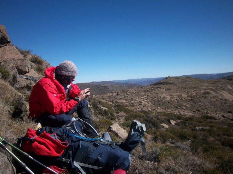
Me on the left and Sean on the right. It was freezing cold. Those K-Way fingerless gloves which you can turn into a mitten work very well I must say.


Looking down to the top of Cockade Pass which ends just right of centre.
It was now that we were hiking on top that we realised it was a more “hilly” than we had both remembered from previous trips around the amphitheater area. On top of a particularly large hill I decided to indulge in a few jelly type sweets to boost some energy. Usually this isn’t a problem but when I’m exercising I’m even more prone to sugar levels and fifteen minutes later a sloping pit stop was required much to the amusement of Sean! All my life I’ve been allergic to sugar and I get an upset stomach rather quickly. So no Coke or chocolates or any of that which isn’t a bad thing I guess.
But bowel movements weren’t the only concern of the day as to the north a large storm was coming. We’d been watching is for a while and shortly after 15:00 we made a dash (we literally ran) for a reasonable looking campsite next to a river and pitched the tent as quickly as we could. I bolted down to the river and was slowly filling my water bottle when I heard Sean say in a hurried voice, “OK come up now!” I ran up to the tent as droplets started falling from the sky. It rained relatively hard and then started sleeting/hailing too. Half an hour later we were outside again, a few small patches of ice around. To the east some huge cumulonimbus clouds were attacking the ground with gusto. Luckily the core had missed us, but not by much. It was then that we noticed two huts in the valley down from us which wasn’t ideal. The cheapie binoculars came out and once again with the low light it was tough to see anything of value, but all seemed clear of people and animals.

If I recall we thought this peak on the right was Elephant and I am pretty sure it isn’t. It was some random.


Osprey 85 Aether that I was using.


Sean with his awesome jacket and it’s monster front pockets which he made good use of.


Elephant is the prominent face on the left.

Sean catching some rays.

Forced to set up camp just after 15:00 as a huge storm was coming. Which led to rain, sleet and then plenty of snow.
After the first storm passed.


Cleft Peak up on the right hand side out of shot.
Later that afternoon we were having a good laugh (I was laughing too loud I think) when we heard shouting across the valley. Possibly someone had heard us. We were camped in a very obvious location, so anyone outside would have seen our white coloured tent from miles away. That ended the laughter immediately. Dinner was prepared and we settled in for a long night of being in the tent. The rain returned shortly after sunset and it came down hard. Suddenly the sound changed to a lighter tone and we realised it was now snowing rather hard. Although we had not hiked very far that day, we drifted off to sleep, still somewhat tense as to our exposed and possibly known camping site. A short while later I heard this loud sliding noise and said to Sean, “What the *** was that?!”
“I thought it was you.”
Came his reply. We listened but heard nothing so I sat up and noticed the tent was rather close to my face. I pushed it away and the same sound resulted. Indeed, the tent was being covered in snow and not really designed to keep snow off, was collecting on top. For a long time afterwards we would hit the tent and knock off the snow. Sleep eventually overcame us and we slept very soundly in the knowledge that the storm would possibly have dissuaded anyone from coming to check out our tent during the night.
Day 3 Summary:
Time: 5 hours 20 minutes
Distance: 8.29 km
Ascended: 522 m
Descended: 341 m
Day 4 – 11 May 2016
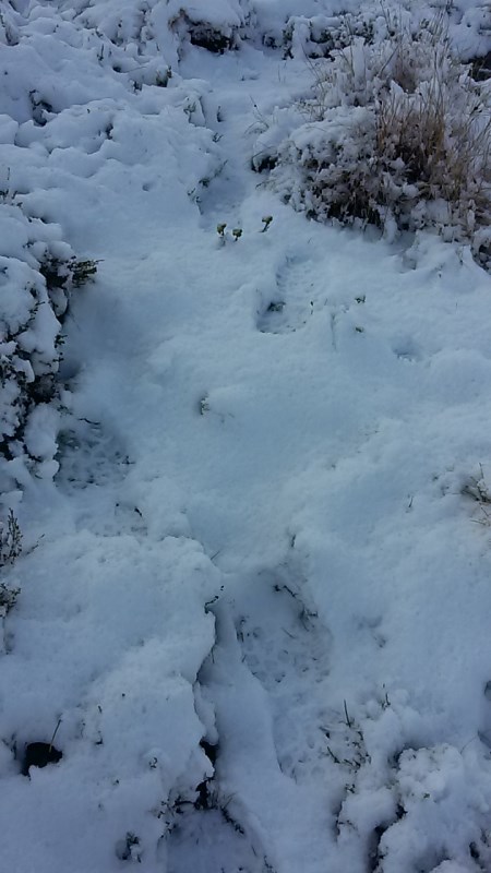
Before sunrise we were up already having spent too long a time cooped up. There was a decent amount of snow outside which was fantastic. In South Africa we don’t get a lot of snow so it was something unusual. It wasn’t that amazing for Sean who had spent a fair amount of time in with snow while working in the Lake District of the UK but for me it was a real bonus.

Early morning, and there was the white fluffy stuff.

First peek outside.


Not too bad.


Stoked!
Following Sean’s footsteps up the back of Cleft Peak.

Selfie as we went up Cleft Peak.
Amazingly, we left camp at 07:38, which was a record for us thus far on the trip. What we hadn’t fully realised in our haste to make camp was that we had camped on the back of Cleft Peak. We made a beeline for the summit through snow that was sometimes higher than our ankles. Sean took the lead as I suffered heading uphill. The wind picked up and it was very cold. As we crested, we realised we were on a false summit. Crossing the small saddle I saw very fresh horse spoor through the snow, as well as those of humans. To our left we eventually saw several horses and two Basoots. One started walking towards us but our pace was hard and with snow falling again and the fact that he had now left the leeside of the cliffs he was sheltering behind, he changed his mind and walked back.
The summit was to put it simply, bloody awesome. The wind, some snow, the clouds, coupled with views down to the valleys below – it couldn’t have been more fitting. Hiking down was another matter and the snow on the southern side was thicker with a wind from the west really chilling our bones. As stated earlier, Sean wasn’t quick on the downhills so progress was slowish and the waiting around made me really cold. Eventually we managed to huddle behind some rocks and eat some food which helped.

The snow was very thick in places.

Sean Robertson, summit of Cleft Peak.

3277m on our map, 3281 on the Wikipedia and 11 metres more here. Close enough!

Adrian Tregoning, summit of Cleft Peak.
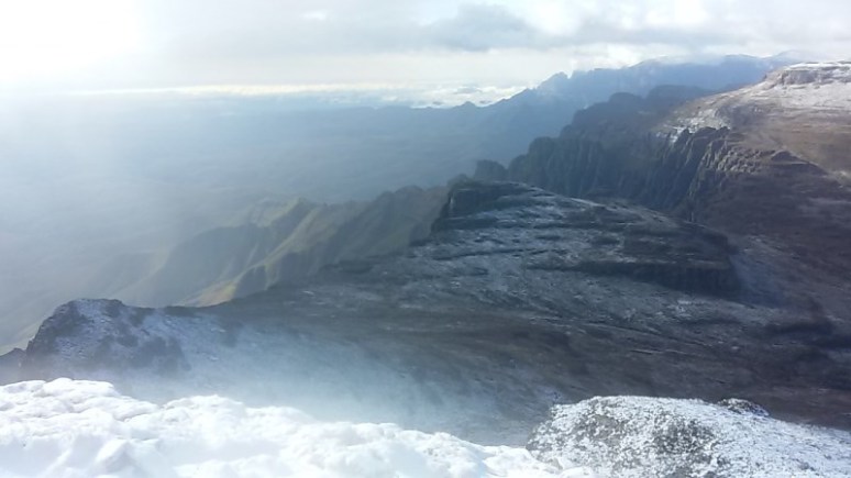
View looking south from Cleft Peak.

Down the other side of Cleft was slow but steady going.
The rest of the day was cold with a lot of up and down. The hill after Organ Pipes Pass was particularly cold and windy. Ironically enough, the spot is called Windy Gap. After much suffering behind Sean for an age, we crested, got out of the wind and found ourselves at a fantastic cave. I’m not certain which one it was, but there is a photo here. This is on the eastern side of the Ndumeni Dome. There are four caves here, and also Rolands if memory serves. It was too early to stop for the day and the spot had no access to water so we pressed on. My rather ambitious plan was to get past Tlanyaku Pass as that is a densely inhabited area according to the very friendly folk at the Vertical Endeavour.com forums. Thank you for all the information and help!

One of the Ndumeni caves.

View from the Ndumeni cave we passed.

This Ndumeni cave has a short climb up the entrance. Awesome little spot!

The youngest look I have 🙂

Looking back and down to Organ Pipes pass from the Ndumeni cave we walked past.
Not long after this we realised there was almost zero chance of hiking past that valley as we were running out of daylight. We saw loads of sheep and saw shepherds on the opposite hills and listened to the bells on their cows. We traversed and cut a diagonal down to cross the Tlanyaku River, and ascended again trying to avoid all people. When we approached the hill south west of Sugarloaf, we saw some cattle descending an impossibly steep cliff. One of the shepherds decided to turn back whilst the other had to continue taking their beasts home. There was no ways to avoid him but I was very certain he would be fine. Curiosity of us and the want to avoid the boredom would surely make it rather vital to make the effort to see two wanders strolling through his country. He had four large dogs with him, but they were extremely subservient. He picked up a rock and gently tossed it towards one and they all cowered and left us alone. The shepherd was very friendly and with a huge smile proceeded to say several things which went well over our heads as we do not speak Sesotho. We asked for the way down and with hand signals and many more sentences we got the gist of it. At the end he said the Sesotho word sikarete and indicated with his hands, but I shook my head and coughed and put my hand on my throat indicating that I don’t smoke and that it’s bad for you. Satisfied with my answer we strolled off and down into the valley we wanted to spend little time in.
By now it was late so we combed the valley and slopes and surprisingly saw now no one, except a few horses on a faraway slope on the far side of the pass entrance. We descended all the way to the bottom but then turned north up along a river to get away from the entrance to the pass. This proved to be a good decision and we had a very pleasant, albeit ice cold, camp site. Four days without any form of personal hygiene bar a daily brushing of teeth called for some attention. The underarms, nether regions and face (not in that order) received some environmentally friendly soap and some ice cold Berg water to wash it all off and I was as good as new.

The Tlanyaku Pass heading down in the centre.


Fiddling with tent poles and feeling the cold a bit.

Setting up camp.

Our camp next to a river north of the entrance to the Tlanyaku Pass.

Sean feeling the evening chill approaching. Ok, I lied, it was cold most of the time 🙂
That night we decided to try out our soya mince from Knorrox and mix it with 2-minute noodles. Soak the Knorrox for 10 minutes and then apply heat they said. The MSR Dragonfly roared to life at full tilt and dinner would soon be ready, or so we thought. It wasn’t long before I realised my mistake that I needed to simmer the contents, and that cooking with a paper thin pot would result in massive burning, which is what happened. Idiot! One would think I had never camped before. Sean took a bite and almost died from the chili and smoky flavour. It was ruined. Intense scrubbing yielded poor results but we had not eaten so another packet was summoned and this time with far greater success. It was a reasonably mediocre meal but one which “did the job”.
As we drifted off to sleep I heard a noise outside and it sounded like someone sneezed. I sat up and listened for a long time, regretting that we had camped in a valley known to be close to a large village but I heard nothing. I fell asleep again but I think Sean didn’t sleep too well that night. Perhaps it was nothing. Maybe some wild animal had chanced across the Knorrox lying in the grass a short distance from camp and was regretting having touched the stuff.
Later that night a few gusts of wind came ripping over the tent. There was hardly any wind but suddenly a gust of 50 or 60 knots came roaring across the tent for about 5 seconds and then it was gone. This happened about four times, each time there was almost no wind in between. In all my 34 years on earth I’ve never experienced such strange wind. And I should know, having been a windsurfer for 17 years already so I am always very aware of the wind! Very weird indeed.
Day 4 Summary:
Time: 8 hours 20 minutes
Distance: 11.82 km
Ascended: 785 m
Descended: 1045 m
Day 5 – 12 May 2016
Thursday morning arrived and I was up at 04:45. Sean was already wide awake. In fact he was sending a Whatsapp. Of course we rarely had signal the entire trip so we’d send Whatsapp messages and then send them when we thought we had signal. I took along a beast of a powerbank at 20 800 milliamp hours. It was overkill and also very heavy and next time I’ll take my wife’s as hers is far smaller and lighter. I used it to charge my cell phone which was very handy for taking photos on the fly, as well as charging my Suunto Ambit Peak 3. I never even got below the halfway mark, although I did keep my phone on flight mode most of the time.

Morning day 5!

Early morning on the fifth day.

The body was starting to rack up some recovery time. But I felt good and ready for far more. How could we have know how long day 5 would be!

Heading up the opposite side of the Tlanyaku valley with a smile on my face. It was extremely cold and the wind was thumping for a short while.
In keeping with our early mornings and eager to get away from this valley, we left camp at 07:27, another record for us. We had gotten into the swing of things and were now starting to enjoy the early starts and long days out. In fact we also realised that if didn’t up the distances we would not even make Monks Cowl. This Thursday would turn out to be a brute of a day.
Heading up past the Didima Dome we made good progress. I was feeling strong and for the first time I was in front on the uphill and Sean still commented. We both felt rather good though and the hiking was fun. As we came around the corner the wind blitzed us for about thirty minutes, at which point we descended past two monster cairns bigger than a man and out of the wind. Yodler’s Cascades is another area I was warned about for encounters with aggressive dogs, so we stayed high up and avoided the area, but almost not high enough. It is a beautiful river and I can fully see the allure of wanting to walk right along its banks. Unfortunately that was not to be and we skirted it. We saw a large kraal and a hut on the opposite bank at a stage and heard dogs barking, time to ascend again. The river down below had drops and slides with some inviting pools. The wind had dropped totally and temperatures weren’t too bad. For the first time in two days I actually took my outer shell off.
Didima Buttress to my right and out of shot.

Just above centre is a kraal and a hut. Hard to see? Sure! On the left are plenty sheep too.

One of the cool drops of the Yodler’s Cascades. Oh how I’ll like to go and kayak those drops in summer! If only I had a helicopter to get in, or a horse.

Route finding.
Just past Didima Buttress.

Just before Didima Buttress actually.
To the south east of Didima Buttress is some very high ground. We summited an unknown peak and my watch indicated an altitude of 3329 metres which was the highest we would ever be on this hike. It was windy and cold up there, so we pressed on, passing two Basotho and two lovely horses with foals from close quarters none of whom had seen us.


Sean at an unknown summit. I’ll find out later what this is.

Altitude at the summit.


Solid wind blowing me around up there.

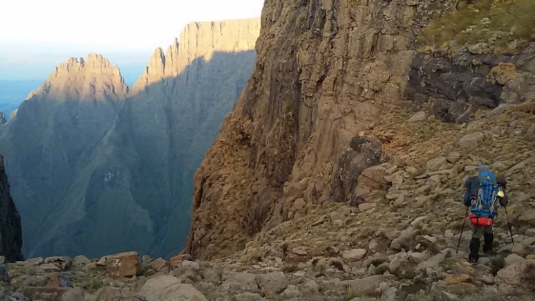
We left the summit and walked off the very dry ridge which leads all the way to Ship’s Prow.
Late in the afternoon we walked past Vulture’s Retreat. It was mind blowingly beautiful. Quite possibly the most beautiful sight I had seen in my life. Perhaps it was the moment or the perfect light I’m not sure, but it was simply amazing to watch the Cape vultures soaring there. But time was running out and we had to find the iNkosazana Cave so we walked around the corner and were faced with a valley full of horses and Basotho. This was less than ideal. We made the decision to avoid the cave and head straight down Grays Pass which would obviously be a full night mission.

Vulture’s Retreat. A poor photo of a very special place.

Vulture’s Retreat.

Looking north from Vulture’s Retreat.

Vulture’s Retreat.
Top of Grays Pass.

Looking down into Grays Pass and the terrible we mistakenly climbed into.

Sean taking the first few steps into the top of Grays Pass.

The top part of Grays Pass.
At the river we filled up our bottles. The sun was setting as we stood on the lip of Grays Pass at 17:15. The gulley leading down was very steep and full of loose boulders. It took only a few minutes of walking before we needed our headlamps. The going was extremely slow as we carefully picked our way down the pass. Sean’s knees were already very painful so I knew it was going to be an exceptionally long night. I was beginning to question the wisdom of our decision, but we stuck with it. It is CRITICAL to know that we made a huge error on this pass. The route descends for about 50 vertical metres, and then exits the gulley to the right. Heading past this point is suicide. We did not know this, and with only our head torches, missed the exit entirely…
Some 150 or so metres down the gulley we came to a large jumble of rocks in the centre. Right looked vertical and totally impassable. Left was also vertical and Sean went first. It looked dodgy but he made it. I followed and halfway I got a little stuck, almost losing my balance. I shouted to Sean that I was in trouble! My pack was stuck on a rock and I was facing forwards. A fall here would guarantee an extended stay in a hospital, if I was lucky. At that point I dislodged a large boulder of probably around 20 kilograms and it dropped and then hurtled towards Sean. He didn’t even have time to turn around as it missed his left leg by a mere half a metre. The adrenaline reached new heights and somehow I managed to extract myself and down climb from my precarious position. We had just had a very near miss and were both very rattled. There was little choice but to keep descending, this time with even more caution.
Imagine being trapped in a narrow gulley around 15 metres wide with walls extending right up to the top, in other words, over a hundred metres and getting deeper. To make matters worse was that we were clambering in a loose scree field. Rocks piled so steeply that standing on them it was a great balancing act as each step would result in rocks being dislodged and creaking and groaning under our mass. It wasn’t a place for humans, certainly not us, and definitely not at night!
The final nail in the coffin was about 170 vertical metres down the gulley some 2 hours later. A huge boulder had once again blocked the way. Sean was slightly ahead of me and said there was no ways to pass. It is so steep that finding a place to remove one’s backpack is challenging. There was no level ground, and zero safety in there. I looked at the left and crept forward. I was terrified to be honest. One slip would be good night. I could see the bottom beyond the boulder and it looked a lot less steep there but the drop was vertical and I could not even get to the edge to peer over. The right hand side was the same. I tossed a rock over and my best guess is that the drop it as least 10 metres as it fell for well over a second. Maybe it’s a little lower, but I doubt it. There was no ways we could pass this obstacle without ropes. We made the only logical decision there was to make and retreated back up the gulley. Sean started ahead as by now his poor knees were taking serious strain and he was in great pain. I sat in the darkness and sent another Whatsapp voice message to the 30 odd people who were being updated to our progress. Throughout the trip I would update the days’ happenings via voice messages which would be much to the delight of everyone listening and made for some very humorous messages. This wasn’t one of them. As I finished the message I turned off my headlamp and sat alone in the dark. Tears streamed down my face. The close call I had experienced, the rock that almost took out Sean, and now this obstacle forcing retreat after a long day had taken its toll. Within a few seconds I wiped away the tears wondering what the hell was wrong with me and focused at the task at hand of extracting myself as well as the person I was partly responsible for. Although one takes accountability for one’s own safety, I somehow felt responsible in the decision for descending this pass and for how it was panning out. My headlamp came on and I quickly reached Sean again where I saw already at a distance that was sitting with his hands covering his face. It was not a good night that.
Back at the spot where I had almost fallen Sean struggled up. I asked him, “How is it?”
“Hard”
I hid below the boulder choke in the middle just in case any more rocks would be dislodged. With the all clear I faced my fear and climbed up. The second left handhold broke free and I almost came pipe as I listened to the rocks falling below me. I forced my way up like an elephant up a tree – gripping the rocks with all my might. But then that was done, but of course we still faced a long ascent.
With agonising slowness and severe pain in his knees we made the rickety scramble back out of the death trap. Fourteen and a half hours out at this altitude with packs over 25 kg’s makes for some hard work. Throw in a 5 hour gulley mission at the end and you are tired. As we emerged into the stillness of the night the stars never looked so good, the time was then 22:00. I vowed never to return to Grays Pass thinking that people were insane to ever go into it! Only on the Sunday night would I log onto the Vertical Endeavour forum with my phone and quickly found out that we missed the turn off and should never have done that far down.
From this blog: https://andybirkett.wordpress.com/2011/04/01/mountain-madness/
“The next morning, we saddled up and headed down Gray’s Pass. Gray’s pass is very well used and is a fairly easy pass, that’s if you find the path which we didn’t. We walked straight down a ravine which resembled a rock slide. The first obstacle in our path was a 2 metre drop over a huge rock. We took off our heavy rucksacks and after Stu climbed down, I dropped the rucksacks down to him and climbed down myself. The next obstacle was a similar drop and we climbed down again. I kept on thinking that we were definately on the wrong path as there was no way people would be able to climb up that way. The ravine had steep sides so climbing out was not an option for where we were. We lost our patience when we finally came up to a drop of nearly 10 metres. We either had to climb back up this pass which might not be possible or we had to try find a way out of the ravine. We found a way out the ravine, contouring along the mountain above a huge cliff, we felt like idiots when we found a lovely path down the mountains.”
So, even in the daylight they made the same error, and the huge boulder is indeed as high as 10 metres, and as can be deduced from the above piece. In my mind, a place of death. I don’t recommend anyone ever check it out.
We had no energy to cook and I don’t even remember what I ate but it was a light snack. The temperature was the coldest yet and I couldn’t get warm. 20 minutes later I got out a protein bar and ate that too. We didn’t concern ourselves with any Basotho and I fell asleep relatively easily.
Day 5 Summary:
Time: 14 hours 27 minutes
Distance: 20.81 km
Ascended: 1201 m
Descended: 945 m
Day 6 – 13 May 2016
I woke up around 04:00 that morning. Sean was awake and shivering. He had not slept at all and for some reason he had not woken me up even though he spent a fitful night half frozen. I think it was the exertion the previous day and dehydration and definitely a lack of food. Right away I got up and got out my stove to boil water. He drank hot water at first and some oats. This helped a great deal. Feeling somewhat thirsty myself I reached for my Platypus bottle but could not drink as the pipe was fully frozen! If it was below freezing inside the tent, I could only imagine what would be waiting for us outside. Quite obviously, it was very cold when we finally got out.

It was incredibly cold the next morning.
We managed to get cracking the earliest time ever that morning, packing away a fully frozen flysheet and leaving camp at 07:00. The going was not fast but Sean seemed to be recovering and left me behind on the first hill which was good news. I had taken a large bag from his pack (about 1,5 kg) as I was better on the downhills and with our imminent descent thought this would be wise, which it was. Ships Prow Pass was the objective and at 08:44 we were at the top at an altitude of some 3300 metres, making it the third highest pass in the Drakensberg. Sean was extremely nervous about the pass after the previous nights’ episode and to be honest I was also fairly tentative. But I’d seen photos and the pass looked good but I couldn’t be totally sure. When we arrived it was a beautiful sight indeed. Not too steep and a fairly decent path.

Double checking navigation in Ship’s Prow Pass.

Me on the mid section of Ships Prow Pass.

Top of Ship’s Prow Pass, followed by a host of photos of the pass.


The northern (right of centre) is very steep and looks incredibly dodgy. It killed one or two people many years ago.


The long forgotten bones of some unfortunate horse.

The “Hillary Step”, an annoying and steep section that we had to get down.
End of the pass, or so we thought. Now the boulders and bushwhacking would begin.
I was expecting a day long day of pain and unhappiness but instead it turned out to be quite excellent for the most part. Sean’s knees were sore, but he didn’t say much in terms of commenting on them and we made slow, but steady progress with many jokes and my incessant and random singing to keep spirits up. The pass is really very good and I must also mention that we did the recommended southern branch. When I looked up at the northern branch, I could see it was a fair amount steeper and full of massive boulders – a scree field. Definitely do not take this route. The southern route is easy to follow and while quite long, shouldn’t pose too many problems. However right at the end they threw in a small Hillary Step. As you leave the slopes and enter the river bed there is a steep section that required us to lower our bags with a length of rope. Cairns marked the spot and it was very obviously the trail. From here we crossed the river, moved downriver a very short distance and entered via a cairn to the left.
I’d not moved than 20 metres when I came across the macabre scene of an aborted foal. At first I stood back and thought we’d stumbled onto a poachers camp, but that wasn’t the case. I moved along the path and within ten metres almost walked into mom. The mare stood looking at me. She had obviously seen years of abuse and a piece of leather was stuck in her bottom lip. The locals do not use a bridle with a bit so they simply loop a rope around the lower lip. However this was only half of that, and embedded into the skin. As she was blocking the path, I walked slowly around through some thick bush and eventually I had to very gently touch her with the side of my trekking pole to get her to move. It is as if she didn’t want us to leave her there. I felt very sad and angry at the same time. If I had been armed I could have euthanised her but I was not armed, was in a national park, it wasn’t my horse and it wasn’t my call. We walked off. My heart was very heavy.

The mare we encountered. I felt so for her. My wife, who is an equine vet, said she’s probably be alright and had seen horses in far worse condition. Yikes! My heart is too soft for animals.

The horse. As a side note, this horse has since died. Another group found it here a month or so afterwards.

The second horse we saw. Note the satan spawn? Oh I mean trees!

The best photo of Sean. This is his “Show me another tree or loose boulder and I’ll kill you” stare. I felt the same, but still felt the need to capture this moment 🙂
The abrupt ending of the pass coupled with the horse and now some intensely thick bush brought spirits down somewhat. Altitude indicated we still had a lot of vertical metres (more than 400!) to drop and walking pace was now considerably reduced. Basically I’ll put it bluntly – it was crap! The river gets broader and turns into a braided stream. There are preciously few cairns and mostly no path. Oh, and there are trees. Several billion of them! We hiked and zig zagged and went left and right but to no avail. Finding a path was pretty much impossible. Sometimes the going was alright, other times it was temper testing. Soon after the first horse we saw a second. She was in far better condition and ran away several times, which helped us follow a rough path. At a stage we found a rough “camp” where someone had slept and later on we found a well worn technical jacket lying in the grass next to an abandoned fire which lay dead. It was a little unsettling as time was running out and we were stuck in the maze.
Towards sunset a few droplets came down which was enough to force us into our jackets but then it died off. Using our headlamps we continued. The trees were winning and a short argument erupted about which way to go. We were both tired and had had enough bushwhacking for one day. The penetration continued and all of a sardine I stumbled onto a dedicated camp site just big enough for one tent! You must understand that the river bed is choked full of boulders and trees and flat ground for a tent simply does not exist. To find this gem in the dark was a stroke of luck. Without hesitation we set up the tent.
Later that evening it rained a bit but otherwise it was an uneventful night. What we did notice was these monster red ants lurking about. So leaving the doors open for any length of time was out of the question. Luckily there were no casualties. Our altitude was 1976 m, and my estimation of the confluence to the path meant we would be close for the final days’ walk. The temperature was certainly far warmer down here but if I recall I didn’t sleep too well.
Day 6 Summary:
Time: 11 hours 22 minutes
Distance: 10.15 km
Ascended: 260 m
Descended: 1350 m
Day 7 – 14 May 2016
The final day had arrived. It was bound to be a fairly average day and at least we’d have a shower and cold beers (did someone mention Captain Morgan?!) waiting at the end. We got off a little later than what we wanted to but left camp at 07:46.
Much to our disgust, the jungle bushwhacking continued. I had opted to walk to Injisuthi because I thought it would be marginally closer, and perhaps easier. A month prior I had hiked 90% of the other route back and I knew it was a very good path and therefore assumed the way to Injisuthi would be as good. Wrong. Only later would I regret my decision. The path is not nearly as good and although not difficult at all we would have made a better speed heading to the Monks Cowl office.

Final morning.

Sean rather stoked to be in the truly beautiful place.

Our night 6 camp was actually on level ground in a man made spot. Really great. Nearby we found two more spots like this.

Final morning, final camp.

The view downstream, oh and those trees…

Lost a boot?

Up the next river, shortly before Sean entered the pain cave. Hey, at least it was warmer here.
The “path” heading up the next river which drains the northern side of Old Women Grinding Corn was quite similar to what we had experienced in the Ship’s Prow Stream, but easier to navigate with quite a few cairns. Still, the going was slow. I felt good and strong and the desire to finish was now strong. Sean on the other hand had slipped into the pain cave quite early on in the day. We got onto the contour path and I was set to put the hammer down and be done. My heart really went out to Sean. He isn’t a man of many words and doesn’t complain much but the look on his face told me everything I needed to know – this was going to be a long day. I’d walk ahead and then wait for him. Throughout the hike we would never be more than fifty metres or so from each other. The waiting look its toll and my feet were really starting to hurt. Truth be told they were already hurting properly the previous day. My big toes were very sensitive and my heels were close on wearing through but I had no blisters. Sean on the other hand had both heels with skin completely off and a very nasty blister on the side of one of his toes. I had given him back the 1,5kg bag and looking back I should have taken it again to help ease the strain.
After the contour path we decided to leave Cataract Valley alone. We saw many trees in the valley floor and a four lettered word popped into our minds immediately so we took the path to the Grindstone Caves. I tried to make jokes but it didn’t help. I sang my crazy songs and that helped a bit but Sean was in serious pain and not a happy camper. There were thunderstorm clouds forming above Champagne Castle and the thought of a lightning storm on these exposed slopes sounded like something I may pass on so an idea occurred to me and I told Sean he better pick up the pace and I tried to make him angry. In my mind this could help increase the pace a bit. It didn’t. Although I’m pretty sure he got pissed off with me!


Ship’s Prow Stream on the right.


One of the Grindstone caves.

The last 2 or so kilometres.

Almost at the Injisuthi campsite.
Towards the end I was also in pain. My feet were seriously sore and my patience was being tested but we would finish this before dark and we would finish together. As we walked down the final hill to the camp site we saw two ladies walking with purpose across the perfectly manicured grass. How could this be? Sean’s girlfriend Anique had driven down from Johannesburg to fetch us (thank you!) and she would have done so alone. Then I thought could this be my wife? Yes! It was indeed. She had flown up from Cape Town to accompany Anique and to surprise me. It was a huge and awesome surprise – thank you! Sean stopped under a tree and emotions overcame both of us. What a hectic ending to the best hike of my life. We were sore, tired and incredibly smelly. My first port of call was removing my shoes followed by a shower. The ladies had taken the last chalet so that was a nice touch, especially as it rained later so we were very grateful because otherwise we would be camping.
Total hike summary:
82,73 km was hiked, 5001 metres ascended and 4935 metres descended.
As cool as these stats may be and as much as the photos may portray an amazing place, there is nothing that describes how good it actually was. It was far better and fulfilling than my feeble words or photos. The odd bit of discomfort, the pain in our feet, huffing and puffing up hills, all of that is soon forgotten. The experience of having actually just being able to see the places that we did and experience it in such a simple manner with all your belongings on your back is something that you have to do in order to appreciate. It is a sort of primitive, primeval sort of pursuit that brings us back to our roots. We are quick to forget that a mere hundred and something years ago we didn’t have motor vehicles or television or air conditioners. Hell we even hunted animals and shot them with bows and arrows and later on, horror of horrors, guns!
<p><a href=”https://vimeo.com/167529965″>Central Drakensberg Traverse 2016</a> from <a href=”https://vimeo.com/adriantregoning”>Adrian Tregoning</a> on <a href=”https://vimeo.com”>Vimeo</a>.</p>

Ship’s Prow dead centre. Who would have thought it could take almost 2 days to hike from the top?

Injisuthi campsite.

I had no tripod but took a few shots in the yellow wood forest.

My wife 🙂


Lauren and I. What a treat for her to fly up to see me at the end! Lucky guy…

Yellow wood forest.

A small yellow wood, dedicated to my father in law.

Last long exposure. I don’t often do these.

Low angle of the chalets at Injisuthi.
To me, getting outside with a backpack or loading up my kayak and threading my way down a river for a few days is one of the best things to do in life. It’s a shame that all too often we don’t make enough time for these sorts of trips. After my father died I really began to evaluate what is important in life. Not that I ever took life for granted, but the moment became a mark in the path that brought many important questions to the surface. Life is indeed short. As my favourite motorbike rider Guy Martin says, “We’re here for a good time, not a long time.” Whilst I don’t advocate reckless behaviour, I think people should evaluate their lives and look at how much time they spend at work or watching television or simply not doing anything worthwhile. There is a whole world out there waiting to be explored, and it begins just down the road from you. Hopefully next year I’ll be able to do this all over again.
Day 7 Summary:
Time: 9 hours 12 minutes
Distance: 15.05 km
Ascended: 434 m
Descended: 940 m
Notes on our food:
Because of my sugar intolerance I obviously steered away from all the sweet stuff. More normal folk would have far more snacks and “treats” but I keep it really simple. Off the top of my head this is typically what I have with me on a hike or kayaking overnight or multiday trips, of which I have done many. Breakfast is typically instant oats. Truth be told I only ate this about twice on the trip. I’ve not drunk a cup of coffee since 1997 and although an avid green tea drinker I was too lazy most of the time to set up the stove, so hence not much in terms of oats and I never even bothered to bring along any tea bags. I blame the cold temperatures, and laziness in the morning. But I did accept a few bags from Sean which was a nice bonus. Otherwise Provita with a small triangle of cheese can go far. I think I got about 8 Provita’s to one triangle of cheese as my record for being a scrooge this trip. Lunch or snacks is usually those John West tuna in the packets. They are rather expensive but the black pepper and lime flavour is delicious and coupled with the Provita they’re a winner. Salticrax and smoked mussels also go down well but I had neither on this trip as I wanted to avoid cans as much as possible. Peanuts and raisins or even plain raisins are some of my favourite snacks but again, on this trip both were left behind. USN have these protein bars of which I had quite a large number – 7 of the big ones and one or two of the smaller guys. I used them during a hike and the protein definitely lets me hike many hours on end. Everyone is different. Try out combo’s on weekends on home turf hikes to see what works for your body.
When we set up camp I’d usually eat a fair bit of biltong (dried meat) to get some added protein in before dinner. An amazing snack and can be used in pasta dishes and all manner of other things, including Smash – which is a “just add water mashed potato powder”. I had two small packets in my bag, but their nutrition is low and we never used it. Two minute noodles and tuna are great for dinner, as is two minute noodles and that soya mince from Knorrox is half alright. We also had our specially discounted Back Country cuisine bags, two each, which made for super easy and tasty meals. Even though they say serves two, it’s two tiny guys who did no exercise the entire day that they’re referring to. Whisky is typical for me, but on this trip I had none to save weight and always be sharp, in case we had to. I dreamt of a glass of red wine one night otherwise I had no desire for alcohol or junk food almost the entire hike. I never starved and meals went smoothly, apart from one Knorrox failure.
Notes on equipment:
Equipment choice is always a personal thing. There are so many good brands out there. It depends what you want and what your budget is. Over time everyone develops their own taste. See what works for you. I just thought I’d compile a few comments as some people may be curious. I consider myself a bit of a gearwhore but this is what works for me. No doubt I can improve here and there when knowledge and budget allows. Sometimes you simply haven’t heard of a fantastic product and then of course there is only thing to do, go and get it!
First bit of equipment – a good hiking partner. Yip, it sounds rather stupid. I’ve known Sean for 17 years now I think and although we didn’t always live in the same towns or cities, we’ve always been very good friends. He knows me, I know him. He can be grumpy and bloody stubborn, exactly the same as me. For all our strengths and weaknesses we make a great team and best of all, we understand each other. When you’re in close confines with someone else you have to be able to be you. You need to fart when you must, say whatever you want and speak up if you don’t agree with a route or decision, talk when talking is required and be silent for hours if that is what the day calls for. We work well together, and there is not another person I would rather have chosen to do anything difficult or remote than Sean Robertson. Sean is a man of solid character and a heart of gold. I know few men like him.
I had the opportunity to get a new Osprey Aether 85 litre at a massive discount but had to pick it up in Johannesburg, so could never test it. I decided to get it anyway for this trip and retire my Karrimor Jaguar 80 litre. This is my review on the Aether 85:
+ Very comfortable, even though I had the honours of carrying the tent and all rubbish so I was on 27kg if you include the 3 litres of water I would typically carry.
+ Very large rain cover – big enough to go over anything extra on the outside of the pack too. The cover is stored in the lid.
+ Great build quality. We had to lower the bags twice and all scrapes and bashings have not shown up. The buckle never popped on the waist band either, which is more than I can say for my mates K-Way bag that must have popped over 70 times during the hike.
+ The lid has a HUGE storage area (under the rain cover) and I was very impressed. Also, with two clips and rethreading one piece of tape one can remove it entirely. There is then a strap which converts it into a “moon bag” of sorts. I removed mine each night and kept it as a “grab bag” in case we had to run away in the night.
+ Mesh external pocket on the outside of the bag is handy for storing jackets and whatever else.
+ The j-zip is handy for gaining access into the bag too.
+ A pocket per side on the hip belt is big enough for a cell phone, pepper spray, compass, that sort of stuff. Decent size.
+ Light weight.
– The side pockets are a joke. You can barely squeeze anything into them. They should have allowed more material there. And I’m not sure why they have that dual hole system. I’d rather have had a deep single pocket either side. Would work for small water bottles, very small ones… I used them to shove in gaiters when not in use. Possibly the only feature I’m not impressed with.
– There is an external hydration pocket between your back and the bag. Looks impressive and neat and clever. However once loaded I think you could maybe fit a litre in there. I could be wrong. I certainly had zero chance of getting the three litre in. One could say put in the bladder then load the bag, however filling up then becomes a pain. I will get a one litre and try it in the future, so perhaps it’s an awesome feature and it’s just me who is not up to scratch.
Overall: Money well spent. Love this bag and can see it serving for many years to come. The storage area in the lid really impressed me the most. I think most South African hikers are still wanting bags with side pockets galore, but with the ample storage on top, you don’t need them.
My tent was also untested even though it had sat in the cupboard for several months. The MSR Mutha Hubba NX is a light weight (2.1kg) 3 person, 3 season tent. It performed incredibly well in wind (never tested in serious and sustained 50 knot plus type wind but it was surprisingly solid), rain, sleet and snow. It’s spacious inside with a handy side pocket in all four corners and little tabs along either lengthways side and in the centre to install a wash line for drying socks etc. An expensive tent but if you want light weight then it’s the winner. Would I buy it again? Possibly yes, but not for the price it currently goes at which is R14 000 I think – insane. I paid R8000 which was already a bit ridiculous. Thanks to our pathetic exchange rate our Rands don’t go very far.
Boots I have a leather pair of La Sportiva’s with a Gore-Tex inner for over 2 years now. Love them. I had Salomon’s before and they were also excellent. At the time I could not get another tough looking pair of Salomon’s so went to La Sportiva. I have their approach shoe the boulder for about 4 years and it is bloody good!
Outer shell is the K-Way Kilimanjaro – I am not impressed. I wore a North Face outer shell for many years, was extremely happy. Then for some reason I cannot fathom I decided to buy a replacement and in my haste I took a Kway Kilimanjaro. This last week I came to really loathe it after having owned it for over a year now and used it a fair bit. Firstly, I like a jacket where the hood packs away into a collar. This keeps you warmer when you’re not using the hood, and if you’re hiking in windy conditions it doesn’t flap around behind your head. Unfortunately the Kilimanjaro does not have that feature. The underarm zippers are very long, which is great – but they’re difficult to open and close without the aid of a friend for some reason. The chest pocket is too small for a map and there is only one of them. I suspect the designers have never hiked with a bag, nor a map. On the inside they decided an iPod pocket would be more fit for purpose – fail. When wearing the hood, your head moves left and right within it which is beyond irritating. At the time in the shop I thought ok it’s not that bad, but I was wrong and again my North Face was better. Breathability definitely feels less than my old North Face. I would rate it 2/5 stars. 3 at a push to be fair I guess. Not everyone would be as concerned with the pockets as me. But the annoying hood should alert anyone to this jacket already.
Whilst K-Way make some great products, and I do like to support local, I feel that they aren’t really the choice for technical gear. Build quality seems good, and I’m sure I’ll get a great deal of use out of it but I am not satisfied. When I buy again it’ll be back to something else. Mountain Hardware is indeed a super brand and I had a tent from them for ages. However their customer service is so bad that Mountain Mail Order would not even attempt to contact them for replacement tent poles when mine started splitting because they said nothing would result and probably why they currently only offer one of their models. So when the tent went bust I sadly left Mountain Hardware alone. But that’s getting off topic.
Sean was hiking in a Gore-tex Mountain Hardware jacket with two monster pockets from the chest to above the hip belt – what a pleasure. I’m not certain of the model.
I had First Ascent waterproof trousers which helped to shield from the wind and cold, unfortunately I did tear them at the crotch but that was my own fault. I’ve had them for years and whilst not very breathable they do keep you warm.
Sleeping bag is a First Ascent Fusion 600 which is a discontinued model but it’s down and rated to -5. I am very happy with it. And used with a liner too.
Therm-A-Rest for my sleeping pad. It’s old, a four season, orange in colour, takes up a bit of space but is super warm and only has one repair. Works well.
Typically I’d wear a long sleeved polyester top (from K-Way) as a base layer. Most of the days I wore two base layers and sometimes even a short sleeve too with the outer shell. When it was colder I had a Cape Storm fleece with a zip but on the uphill sections I’d overheat. It’s always tricky. You will either be too hot or too cold for extended periods and that’s the nature of the game. My First Ascent down jacket I slept in most nights, and after a long sweaty day I could change into a dry polyester top and put on the down jacket and I’d be totally fine. I hiked with two Buffs and two beanies. One would be more sleeping, the other for hiking. In the end it was probably a waste, and on the colder day I wore both Buffs. I left my thick windproof one at home that I use for riding motorbike but Sean had one and I eyed it out with jealousy.
I bought Under Armour compression underpants to avoid chafe for a whopping R650 and after the first day I already had chafe on two lines under my buttocks – not ideal! I then donned a cheap Mr. Price pair and they worked so well I wore them for 6 days straight. Yep, pretty disgusting but chafe is to be avoided. At night I’d sleep in a normal pair of boxers and some compression socks.
I took along my MSR Dragon Fly stove. We didn’t use it too often. Sean also had a stove and we used his about half the time, maybe more. We rather hiked with two stoves in case of mechanical failure. I may take along my MSR Pocketrocket next time purely because it’s so much faster to set up. MSR pots too, they make brilliant products.
My trekking poles are some ancient Black Diamonds. On day 7 I took a solid fall in the boulders and bent one badly. It took about 10 attempts with all my strength to bend it back into a roughly straight shape. I was impressed with their strength. They’re old but they work.
We had maps, both of us Garmin GPS’s and I had a Silva compass too. We both took two headlamps each and spare batteries. My choice is Petzl and I think both of Sean’s were too. The Tikka XP 2 has a handy red light which makes for a more pleasant experience for your tent mate late night/early morning as the light isn’t that harsh on the eye. I believe this model is discontinued. It had that sliding bit for casting a wider beam but mine got sand in and I broke it, perhaps this was too fiddly and hence the discontinuation.
I took a chess set with, we never played once. Luckily it’s tiny. My 20 800 miliamp hour powerbank was overkill, and heavy. But it helped keep our phones charged. I also had my trusty old Nokia that I bought brand new for R160 about 4 years ago too. The battery lasts just under 2 weeks. Proper old school for the win!

Enjoyed your adventure. Stunning photos of a truly spiritual place. Thanks for sharing.
Nice photos of an awesome hike…well done!!!!